

Results 1 to 10 of 25
Thread: RallyVista, 3D animated maps
-
10th January 2015, 12:18 #1Member

- Join Date
- Jan 2014
- Posts
- 77
- Like
- 0
- Liked 10 Times in 10 Posts
RallyVista, 3D animated maps
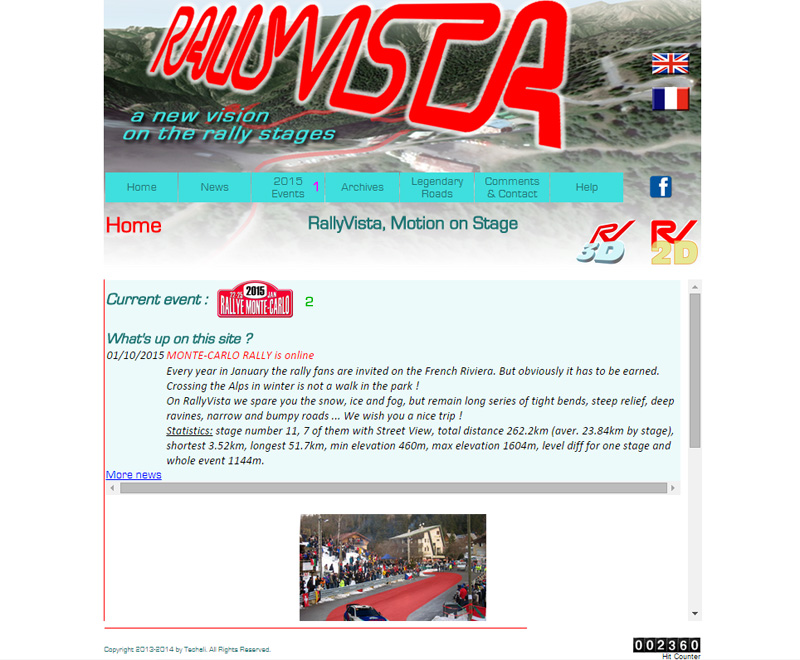
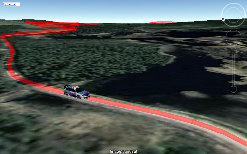
For one year now, RallyVista site shares WRC stage maps under a 3D animated form.
You'll find it at http://www.interactiveinfluence.com/techali/rallyvista/
We though that instead static and flat map, a 3D display using all Google Earth applet features, would better show rally roads characteristics, difficulties and athmosphere. On this site you will virtually follow a car on the 3D map and thanks to beacons and distance+elevation indicator you will be able to locate it in the space.

-
19th January 2015, 12:15 #2Member
- Join Date
- Jan 2014
- Posts
- 77
- Like
- 0
- Liked 10 Times in 10 Posts
If you fail to run the application, here are some tips:
First, use the right browser. The application was designed for Google Chrome or Mozilla Firefox. For technical reasons, we were unable to adapt it to MS Explorer.
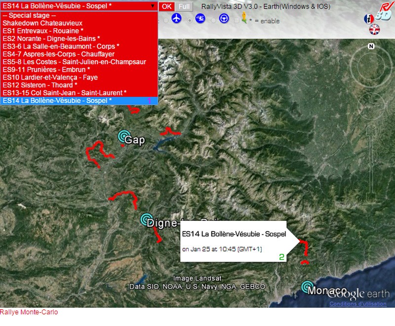
On the home page, select "2015 Events" (1) and then the rally you want to explore. You can also directly go to the current event by clicking on the rally plate (2).
At first, when arriving on the rally page, you will be prompted to download Google Earth applet. Click on the link and possibly restart your browser to complete the installation.
-
19th January 2015, 12:19 #3Member
- Join Date
- Jan 2014
- Posts
- 77
- Like
- 0
- Liked 10 Times in 10 Posts
From the event overview, you can select the stage you want to view from the drop down menu (1) or by clicking on its route (2) (a label appears, you can delete it by clicking anywhere in the window). Click “OK”.
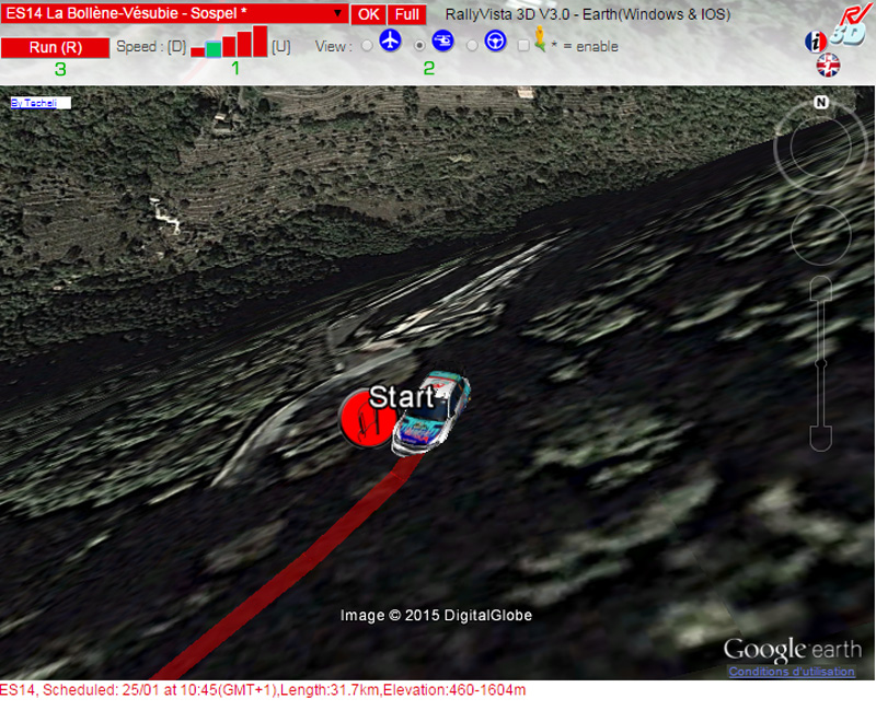
You are then taken to the start of the special. Wait until the car is on the line. Set your pace (1) (the speed of the car on your computer depends on your Internet connection) and your favourite view (2). Click "Run" (3) and go!
Last edited by Criterium; 19th January 2015 at 12:25.
-
19th January 2015, 12:28 #4Member
- Join Date
- Jan 2014
- Posts
- 77
- Like
- 0
- Liked 10 Times in 10 Posts
Here's what you get with the default settings:
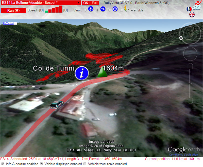
On the dashboard (the stripe under the window) is displayed the following information:
- Left generic data: number and name of the stage, schedule, length, min / max elevation (this information comes from organizer official documents and, for elevations, the most accurate available topographic maps)
- Right the situation of your car: distance already traveled, elevation (data is directly taken from the Google Earth applet and often contains few meters inaccuracies)
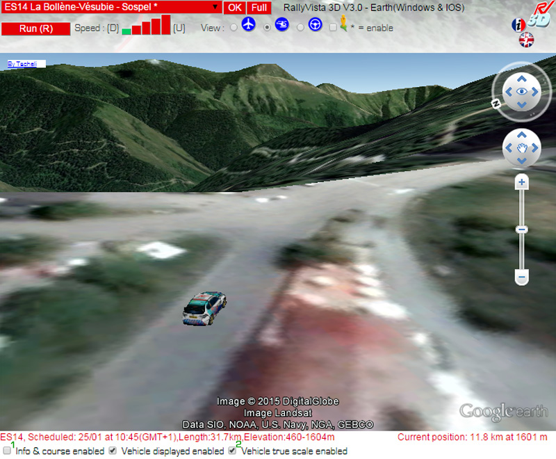
To add realism, it is possible to remove the line on the road by unchecking "Info & enable race" cell (1) and / or put the car in scale 1 by checking "Vehicle true scale enable" (2 ).
-
19th January 2015, 13:06 #5Member
- Join Date
- Jan 2014
- Posts
- 77
- Like
- 0
- Liked 10 Times in 10 Posts
You can imagine yourself as a crew member by clicking the inboard view:
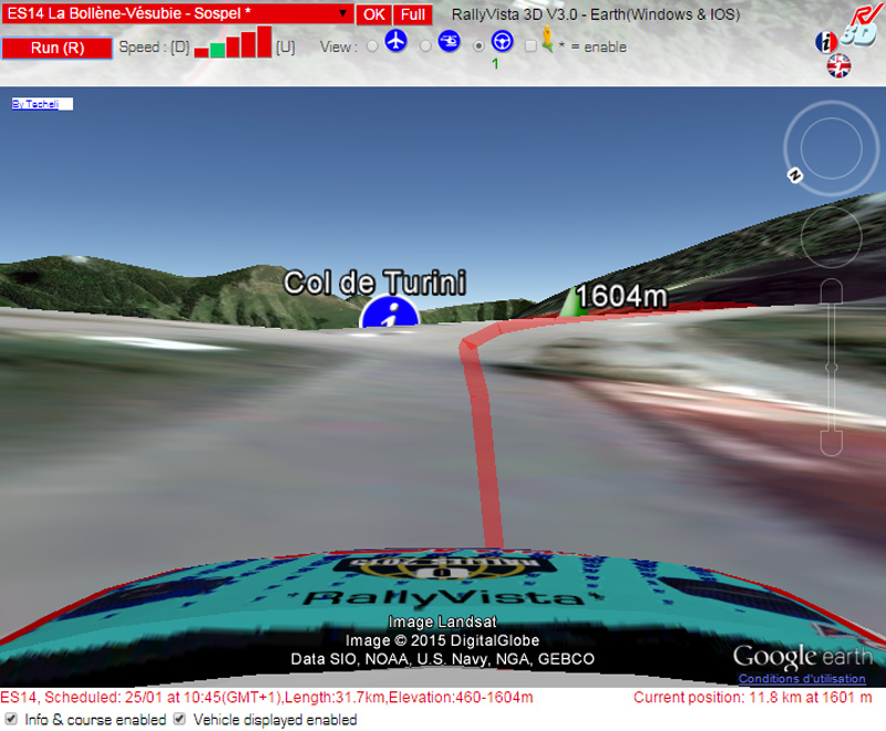
Unfortunately, the show is marred by a very imperfect road relief modelling (it is understood that Google offers for free the entire Earth's surface from satellite pictures and it is already wonderful!). I suggest you rather to use the Street View option when available (we make it available when every stage road is "covered" and point out it to you with an asterisk next to its name).
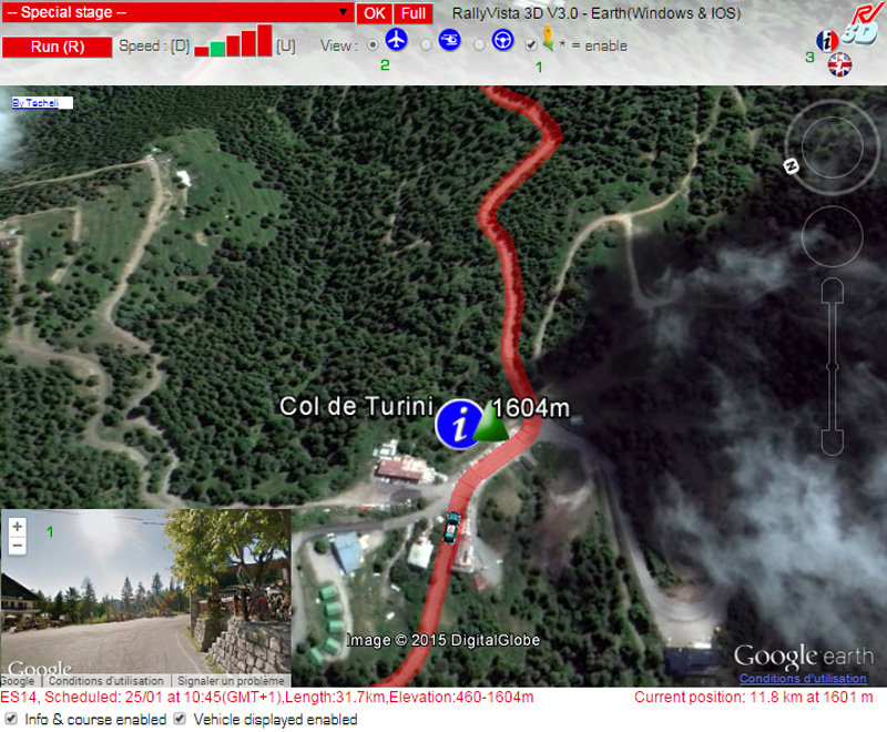
For this you have to click next to the Street View guy (1) preferably from the stage start. At that time a window appears in the bottom left corner. We suggest you to pair Street View with aerial view (2) that simultaneously provides an overview of road difficulties and helps to better situate your car.
At any time, help is available clicking “i" icon with the flag corresponding to the preferred language (3).
-
19th January 2015, 13:11 #6Member
- Join Date
- Jan 2014
- Posts
- 77
- Like
- 0
- Liked 10 Times in 10 Posts
Wishing you a very good time on RallyVista across World rally stages. Do not hesitate to make your comments or ask questions. For us it is very frustrating to spend as much time to develop this application for each event and stay with so few feedback. So I am relying on you!
http://www.interactiveinfluence.com/techali/rallyvista/
-
31st January 2015, 22:25 #7Member
- Join Date
- Jan 2014
- Posts
- 77
- Like
- 0
- Liked 10 Times in 10 Posts
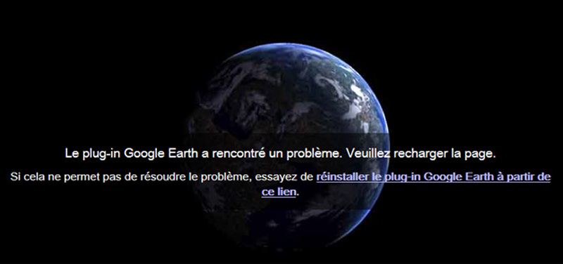
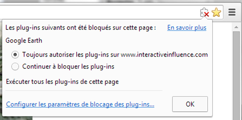
We are currently working on the animation for Rally Sweden. I recently had a surprise using Google Chrome. The navigator locked the window and ask to allow the Google Earth plug in to start :
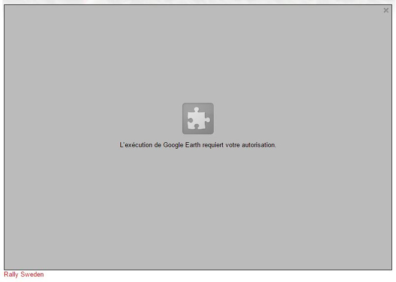
Don't worry, if you have the same problem go to the right end of the menu bar and click on the puzzle part icon. Check the first cell to allow plug-ins on interactiveinfluence.com which hosts the RallyVista site.
-
8th February 2015, 14:42 #8Member
- Join Date
- Jan 2014
- Posts
- 77
- Like
- 0
- Liked 10 Times in 10 Posts
This week it's "When Snow White meets the rally". To know what is hidden under the swedish ice go on Rallyvista:
http://www.interactiveinfluence.com/techali/rallyvista/
- Likes: dodge33cymru (8th February 2015)
-
28th February 2015, 10:01 #9Member
- Join Date
- Jan 2014
- Posts
- 77
- Like
- 0
- Liked 10 Times in 10 Posts
The application for Rally Mexico should be ready... Unfortunately Google updated Guanajuato's view 2 days ago. We are working hard to check in time.
-
3rd March 2015, 08:15 #10Member
- Join Date
- Jan 2014
- Posts
- 77
- Like
- 0
- Liked 10 Times in 10 Posts
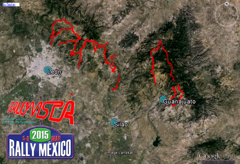
Google did not make our life easy but Rally Mexico is finally online !
http://www.interactiveinfluence.com/techali/rallyvista/

 Reply With Quote


In the past, the higher the number of spectators on the WRC stages, the more spectator-related problems there were, which often led to the WRC stage to being cancelled or the rally cars passing at...
[WRC] Croatia Rally 2024